HIGH RESOLUTION UAV IMAGERY
Our high resolution video and photo gives you the ability to see your project clean and clear. Is your project in a tight spot? Vertical Imagery's skilled pilots can get the unmanned aerial systems (UAS) within 15 feet of most structures. Fortunately, our high powered cameras mean we seldom need to and you still get uncompromising image quality. If your plan calls for aerial video then our ability to shoot high quality 4k video is just what you need. Vertical Imagery consistently delivers professional still images and production caliber video. Contact us so we can get to work for you!
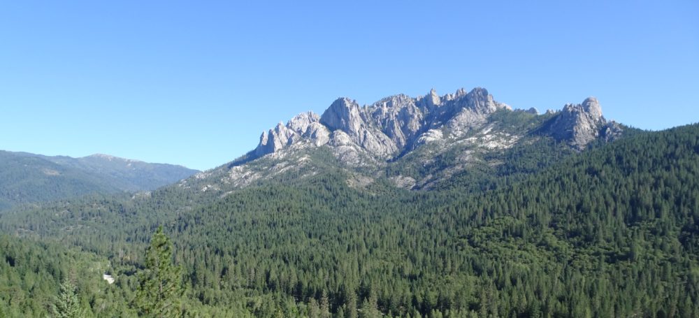
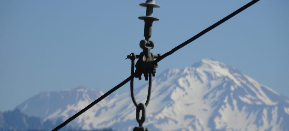
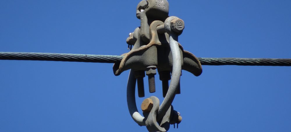
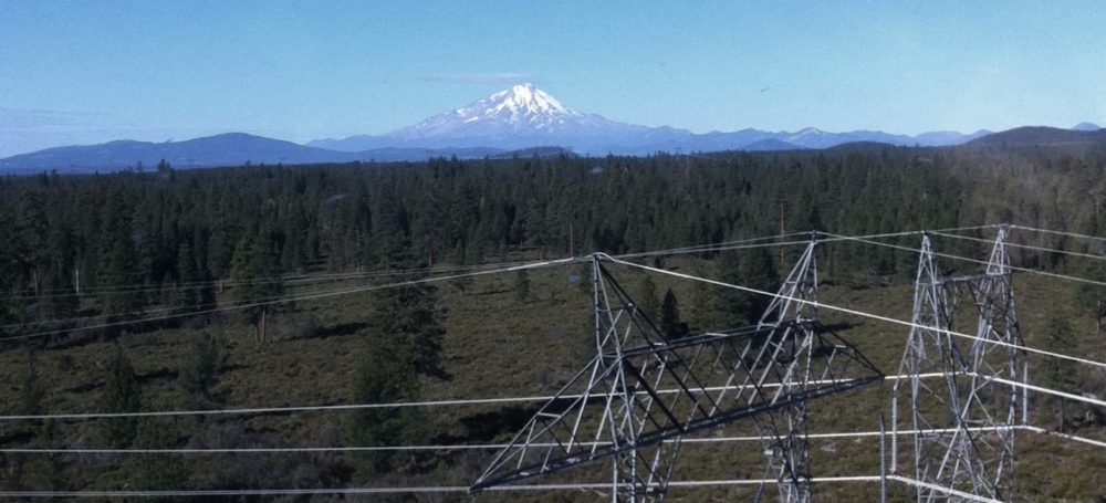
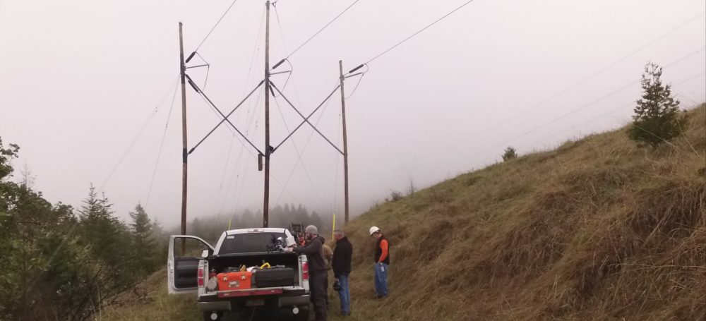
UAV ASSET MONITORING
Our utility partners rely on our ability to monitor utility line conditions all over the Western United States. Vertical Imagery has the ability to rapidly deploy our UAS to any location at any time because we realize emergencies are never planned. We can give our clients up close reliable images without putting any inspectors at risk. When the issue is found you can send your repair team up with knowledge they need to get the job done. Our quick activation and ability to monitor from the sky can keep your assets safe and in working order. So if you need to keep an extra eye on things let us know!


3D POINT CLOUD MAPPING
Vertical Imagery can fly a pattern over any project taking high resolution videos that can be turned into 3D point clouds. Does your company have a need for point cloud mapping? Because with our in house analysis we can do all the work for you. This technology is extremely beneficial in industrial inspection and Geo-referencing but can be used in a wide variety of applications. If your project needs a 3D point model allow our UAS to do the hard work!
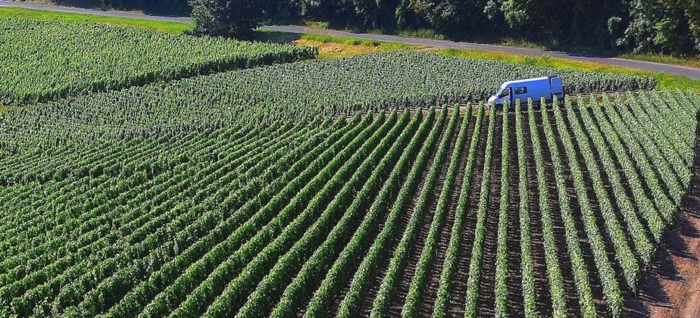
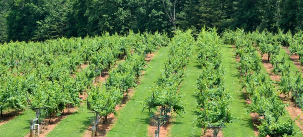
MULTISPECTRAL IMAGING
Multi-spectral imaging is the future of agriculture and Vertical Imagery is ready to help increase your yield. Our unmanned aerial systems give us the ability to fly a route over your crop taking high resolution video. Once downloaded to our system our in house analysis gives you the data you need to grow wild. Precision agriculture can drastically increase your crops output and Vertical Imagery has the tools and know how to accomplish all your goals. Let us utilize precision agriculture so you know every detail about your plants, soil and water. Southern Oregon is the new Napa, let our technology give you the wine of your dreams!
Let us Customize your UAV Aerial Imaging Plan!
These are just some of the services we offer. If you have a vision we can develop a plan for you. If you or your company have any unmanned aerial photography or aerial videography needs give us a call. With a long standing history in the industrial and commercial safety and inspection arena we have the knowledge and experience to succeed for you!